


Voting District 0340, Parker County, Texas
About
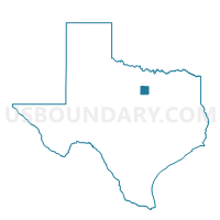
Outline

Summary
| Unique Area Identifier | 676377 |
| Name | Voting District 0340 |
| County | Parker County |
| State | Texas |
| Area (square miles) | 51.97 |
| Land Area (square miles) | 51.40 |
| Water Area (square miles) | 0.58 |
| % of Land Area | 98.89 |
| % of Water Area | 1.11 |
| Latitude of the Internal Point | 32.59972800 |
| Longtitude of the Internal Point | -97.99101300 |
Maps


Graphs
Select a template below for downloading or customizing gragh for Voting District 0340, Parker County, Texas


Neighbors
Neighoring Voting District (by Name) Neighboring Voting District on the Map
- Voting District 0001, Hood County, TX
- Voting District 0007, Hood County, TX
- Voting District 0008, Palo Pinto County, TX
- Voting District 0010, Palo Pinto County, TX
- Voting District 0320, Parker County, TX
- Voting District 0330, Parker County, TX
- Voting District 0335, Parker County, TX
Top 10 Neighboring County Subdivision (by Population) Neighboring County Subdivision on the Map
- Weatherford CCD, Parker County, TX (37,677)
- Granbury West CCD, Hood County, TX (9,262)
- Palo Pinto-Santo CCD, Palo Pinto County, TX (3,777)
Top 10 Neighboring Place (by Population) Neighboring Place on the Map
Top 10 Neighboring Unified School District (by Population) Neighboring Unified School District on the Map
- Granbury Independent School District, TX (47,990)
- Weatherford Independent School District, TX (47,338)
- Brock Independent School District, TX (4,215)
- Millsap Independent School District, TX (3,949)
- Santo Independent School District, TX (3,201)
- Lipan Independent School District, TX (1,943)
Top 10 Neighboring State Legislative District Lower Chamber (by Population) Neighboring State Legislative District Lower Chamber on the Map
Top 10 Neighboring State Legislative District Upper Chamber (by Population) Neighboring State Legislative District Upper Chamber on the Map
Top 10 Neighboring 111th Congressional District (by Population) Neighboring 111th Congressional District on the Map
- Congressional District 12, TX (831,100)
- Congressional District 17, TX (760,042)
- Congressional District 13, TX (672,781)
Top 10 Neighboring Census Tract (by Population) Neighboring Census Tract on the Map
- Census Tract 1406.02, Parker County, TX (9,585)
- Census Tract 1603.02, Hood County, TX (3,822)
- Census Tract 3, Palo Pinto County, TX (3,777)